
Date uploaded: 2022-01-18 17:07:59
A thick layer of volcanic ash blanketed Tonga in new images showing the aftermath of Saturday's massive undersea volcanic eruption and tsunami that sparked fears of widespread disaster.
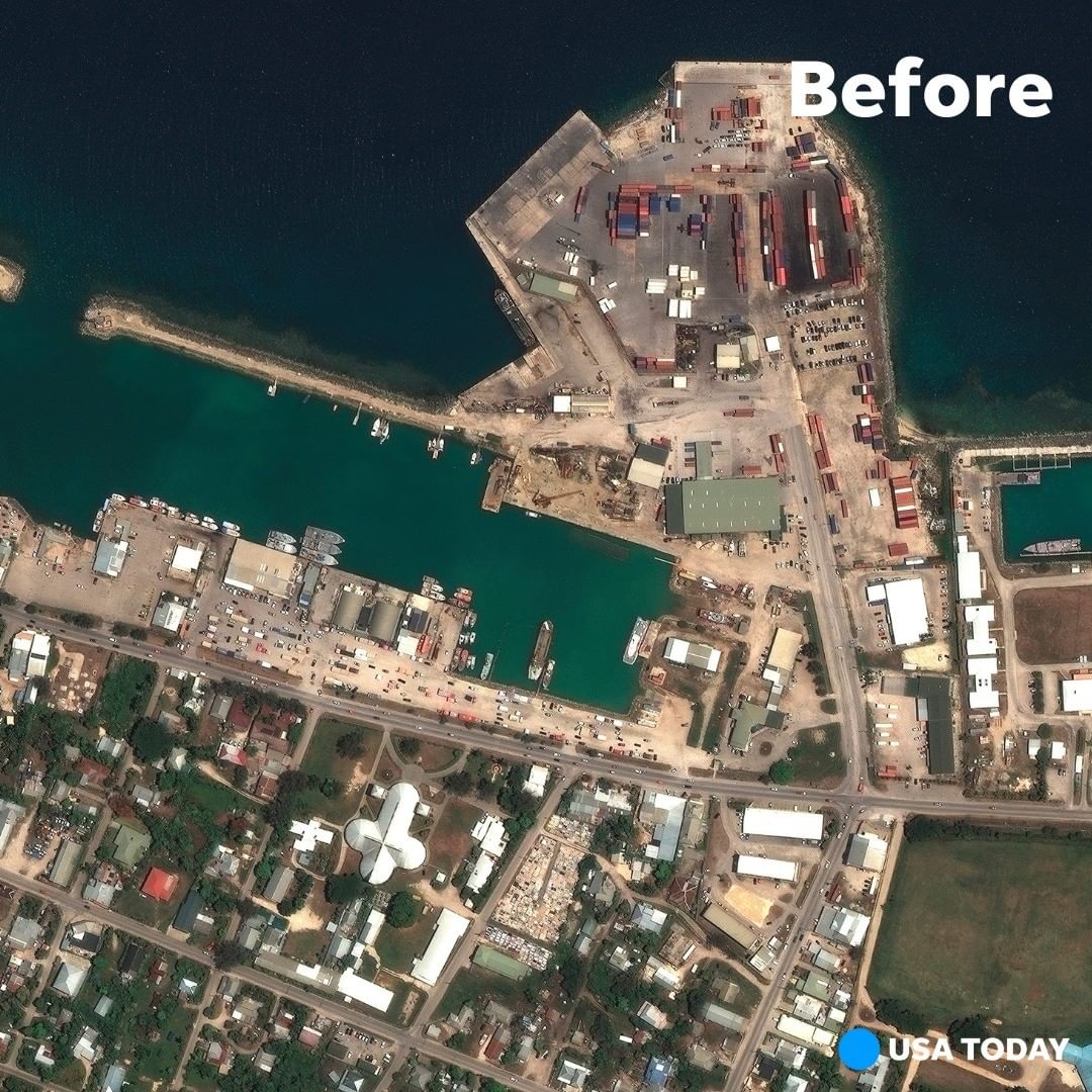
Aerial and satellite photos released by New Zealand, Australia and UNOSAT, the United Nations satellite center, show once green, lush islands smothered in dark ash. Water from large waves that crashed ashore after the eruption can also be seen, alongside wrecked buildings.
These stunning satellite images show the eruption of the Hunga Tonga Hunga Ha’apai volcano, which propelled a 3-mile-wide plume of ash and gas resembling a giant mushroom to about 12 miles above the water. Tsunami waves resulting from the explosion sent people rushing to higher ground, and the eruption disrupted communication with the small island nation over the weekend.
Yet Tonga avoided the widespread disaster many had feared, and tsunami waves rose only to about 2.7 feet. Tonga has reported two deaths, but concerns remain over the impact on two smaller islands as fractured communication continues.
Swipe to see the before/after images depicting the impact of the eruption, and tap our link in bio to read more!
📷: Getty Images, AP, Planet Labs, Maxar Technologies via AP